882
Published on June 1, 2016
Geo-data and information are essential for planned development of the country in which the country has dearth; she said necessary law and policy would also be framed to check misuse of the data and information.
The Prime Minister was inaugurating a two-day international seminar on "National Spatial Data Infrastructure for Bangladesh" here on Wednesday.
Department of Survey of Bangladesh (SOB) and Japan International Cooperation Agency (JICA) jointly organized the seminar at city's Pan Pacific Sonargaon Hotel aimed at constituting the National Spatial Data Infrastructure (NSDI).
Sheikh Hasina said NSDI would help development planning of the land, ensuring optimum utilization of the land. "A national committee led by the Ministry of Defense will be formed to formulate short and long term plan, fix up action strategy and provide necessary assistance to develop the NSDI," she said.
Senior Secretary of the Ministry of Defense Kazi Habibul Awal, Japan Ambassador to Bangladesh Masato Watanabe and Chief Representative of JICA in Bangladesh Mikio Hataeda also spoke on the occasion while Surveyor General of Bangladesh Brigadier General Mohammad Abul Khaer gave the welcome address.
Sheikh Hasina said, once the NSDI is formed, research organizations as well as teachers and students of various public and private educational institutions would be able to connect with geo-spatial information flow without any interruption.
She said various government and private organizations now separately prepare, use and preserve information and data of the earth surface. "All those organizations need to bring under the same umbrella under a policy framework for preservation of data and information," she said.
The Prime Minister said NSDI would play very important role for sustainable development of the country through avoiding duality in data preparation and easing exchange of accurate and up-to-date data and information. "Besides, use of data from the same domain will also help save money and time and thereby accelerate country's development activities bringing dynamism," she said.
Sheikh Hasina said, "NSDI will preserve geo-spatial data in a same platform helping all users to use the data according to their need, which we feel very much at the time of taking a project."
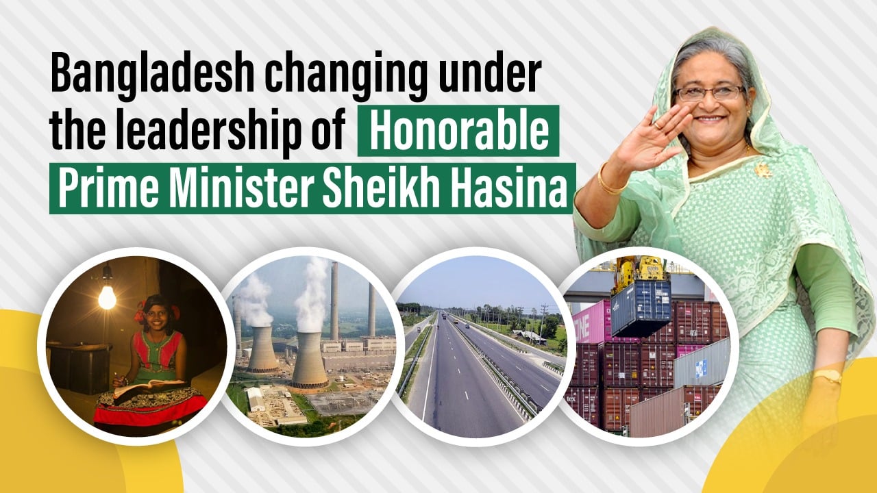
She said Bangladesh is a unique place of natural beauty, bio-diversity and geographical composition as well as bountiful with huge resources. "So the country needs careful use of land for maximum utilization of the land resources," she said.
Pointing out her government's plan to establish 100 special economic zones in the country without causing any damage to the arable land, the Prime Minister said Bangladesh is a small country with high population density.
"Scarcity of land is a huge problem here while conservation of land is crucial to feed people and industrial development. River erosion is also devouring a sizeable land every year," she said.
Taking all those factors into consideration, we have to be careful in land use, she said adding, "We can know about the nature of the land and its geo-natural composition by using the modern technology."
Sheikh Hasina said, huge agricultural lands of the country are being lost every year due to river erosion. "Side by side new chars are also waking up from the sea. Ways have to be developed to make the new chars useful through proper survey," she added.
In this connection, the Prime Minister directed the Survey of Bangladesh to conduct a topographic survey on the new chars and islands woke up across the sea coast.
Expressing satisfaction over Survey of Bangladesh that extended cooperation towards the Foreign Ministry by making 48 maps of coastal areas, she said, the SOB already completed making of digital maps of different scales. "Besides, the SOB is also working to prepare digital Maps of entire country including Chittagong Hill Tracts in a large scale," she said.
The Prime Minister mentioned that the SOB has already completed making of 900 map sheets out of 988 while works on preparing Digital Elevation Model-DEM and Digital Terrain Model-DTM are progressing.
Later, the Prime Minister also inaugurated Digital Mapping Centre set up at Damalkot, Mirpur.


This work is copyrighted and authorized by the Bangladesh Awami League. You may download, display, print and re-produce this material in unaltered form only (retaining this notice)for your personal, non-commercial use or use within your organization.